A day at Thung Tuk (“Toon-Tick”)
Step one on the 'Thai Silk Road'
11th March 2011.
Google maps link to my detailed map of the site:
The Thai Silk Route. This is the Thailand section of the long southern Silk Road, from Arabia, to India, then across the Malay Peninsular, over what is now the modern Kingdom of Thailand, then northwards to Vietnam and China. This post deals with the first stop on the route, Thung Tuk, #10 (I like to number things).
 |
| Northern Phang-nga province of southern Thailand, showing Takuapa and Koh Kor Khao (island). |
To being, there is one thing I am sure of, classicists have it easy when it comes to research. Sitting in a library, aircon of course, reading books, journals, and then attending scholarly conferences. Way to go. Not so archaeologists: heat, bugs and slugs, weeds, dirt—all the fun things. This was the case on the island of Koh Kor Khao, where I explored the ancient site of Thung Tuk.
First, a few words of advice: when prowling around archaeological sites in the tropics, keep moving—this will keep ants from climbing your legs, and carry a stick to whack away spider webs and to generally hit things, and watch where you step. The stick is also handy as a measurement guide in pics.
 |
| Thung Tuk |
Anyway, onwards. I travelled from the town of Takuapa, where I was staying at the Extra Hotel (not sure what is the extra, fairly average mid-range hotel, and no breakfast even though this was promised on website) to the island of Koh Kor Khao, ~8 kms due west, via a tuk tuk and a ferry. Then a motorbike ride to the ‘ancient city’, as the site is portrayed on the local tourist maps. Thung Tuk is on the south-eastern side of the island, near the mouth of the Takuapa River, facing the mainland. This sheltered area was used as a harbour by merchants to land their goods for the onward journey across the peninsular.
I noticed, as I was being ferried across to the island, that the ‘edges’ (I am sure that there is a technical term) of the land on each side of the entrance to the Andaman Sea projected further into the water than is indicated on google maps (gmaps also states that there is a bridge over this water, which is most definitely not the case!). Also, that the water across the entrance to the river was foaming. This suggests to me that this water is narrow, shallow, and has sandbars. My single observation depends on tides and so forth, but it does suggest that this was a sheltered harbour area, certainly suitable for the small ships of antiquity and the medieval era.
I did also note that there were a fair number of ships placidly anchored in this stretch of water. Suggesting that this is indeed a placid stretch of water, and most likely so one thousand years ago. An ideal location at which to beach one's ships and transfer one's goods for the journey overland.
I did also note that there were a fair number of ships placidly anchored in this stretch of water. Suggesting that this is indeed a placid stretch of water, and most likely so one thousand years ago. An ideal location at which to beach one's ships and transfer one's goods for the journey overland.
Thung Tuk is easy to find, in fact it is sign posted all the way. The area concerned is set back from the Takuapa River ~250m, however, a millennium ago the River may have been closer. It is also flat, the land here is level, my gps gave an altitude ranging between 15 and 20m over the site (as compared to 10m at the ferry landing site). In this southern area of the island there seems to be the highest area of land.
At the entrance there is an uncompleted tourist office and mini-museum. Obviously, plans are afoot to publicise the history of the area, and to increase the not too large number of tourist attractions on the island.
At the entrance there is an uncompleted tourist office and mini-museum. Obviously, plans are afoot to publicise the history of the area, and to increase the not too large number of tourist attractions on the island.
 |
| Tourism centre. |
Having arrived, what does one see? Jungle. The land in question is partially cleared jungle, which is to say, lots of trees, bamboo, leaves, bits of wood, and a few clear spots. In this area, approximately 250 metres on a side, which is delineated from its surrounds by a narrow dirt track, are the eight individual sites. Each of these are the remains of a small construction, however, all that is extant is the foundation of each, plus debris, which together serves to give some indication of the individual use. The foundations of two of these sites are clearly visible: site 3 & site 4. The first of these has a plaque, briefly describing the ruins. The latter does not, but has been fully uncovered, and is larger, with a more complex design.
In general the buildings follow a common design. An enclosed area, with a central dais upon which was almost certainly a religious figure. No doubt other related accoutrements and adornments were to be found on the originals. It is also reasonable to assume that, when Thung Tuk was a busy trading emporium, this now quiet and isolated area was fully cleared and filled with traders, sailors and others, from both east and west, coming and going about their business— 'networking' as we would say in the modern world.
To understand the dearth of artefacts and remains present, one must understand the regrettable history of Thung Tuk. It has been harshly looted. Most likely for generations locals have dug through the remains of these buildings in search of valuables. Prior to excavation, each site had multiple looters’ holes, dug down in search of portable wealth. What was not carried off was badly scattered, much restoration work had to be done by the Fine Arts Department to reconstruct what we have now.
 |
| Sign at tourism office. |
In general the buildings follow a common design. An enclosed area, with a central dais upon which was almost certainly a religious figure. No doubt other related accoutrements and adornments were to be found on the originals. It is also reasonable to assume that, when Thung Tuk was a busy trading emporium, this now quiet and isolated area was fully cleared and filled with traders, sailors and others, from both east and west, coming and going about their business— 'networking' as we would say in the modern world.
To understand the dearth of artefacts and remains present, one must understand the regrettable history of Thung Tuk. It has been harshly looted. Most likely for generations locals have dug through the remains of these buildings in search of valuables. Prior to excavation, each site had multiple looters’ holes, dug down in search of portable wealth. What was not carried off was badly scattered, much restoration work had to be done by the Fine Arts Department to reconstruct what we have now.
To accomplish this reconstruction the archaeologists first had to clear each site of vegetation, next it was necessary to dig down a metre or so to reach the actual foundations. Then followed the work of completely uncovering each site, finally, the most painstaking stage, reconstruction of the remains.
Yet, even with generations of looting, items remain. Many items from Thung Tuk are religious in nature, however, there are a goodly number of mundane. The most prevalent of these, terracotta pottery. This was most likely deemed insufficiently valuable and too fragile to be worth looting. What remains is broken but identifiable. This pottery is both locally produced, while some is imported from China, most likely for further export westwards. There is also glazed pottery from Persia, which was also most likely in the process of being exported, but this time eastwards to China. Beads were also found, in great number, style, and value. As beads are small, travel well, and are a luxury item, these were destined for other markets. There are also small glass items present. These are glass bottles, suitable for perfume or medicine or other valuable liquid. Larger items were religious in nature, parts of sculptures of various divine figures, in particular Ganesh. As Ganesh is considered the remover of obstacles, and a source of wisdom, his worship by merchants and sailors is certainly understandable.
In addition to the actual construction sites, the archaeologist dug two pits to uncover what might be randomly distributed across the area, at sites away from obvious areas of human habitation. What was found was a scattered variety of items: sherds, fragments of iron and glass, and beads. These items were found ~30-40cm deep, in a of layer of ~20-30cm.
The period indicated by the archaeological remains stretches between the 8th and the 11th centuries AD. This period began with advances in shipping technology, which allowed ships to sail directly across the Indian Ocean, making Thung Tuk a better landing site than the earlier to the north, and ended with further advances, which facilitated movement through the Malaka Straits. This background is more fully discussed in the previous blog post, which discusses the 'Thai Silk Road' in more detail.
What is intriguing, though not surprising, is that these buildings were all religious in nature. The humble wooden structures in which these people lived and worked are now lost to the elements and to time, but the stone and brick survives. This is a world wide phenonenom. Exploring Thailand, and south east Asia in general, over the last few years, has shown me just how important religion was to people in earlier cultures. In low tech societies, people lived hard and demanding lives, surrounded by a dangerous and unpredictable environment. Religion, or simply some means to ask for ‘good luck’ from this harsh universe, was omnipresent throughout society and inherent in every person’s life.
A question which comes to mind is, what is the internal chronology of Thung Tuk? In what order were the buildings constructed. Most likely the smaller first, then, in keeping with the general competitiveness of religious construction, larger and then even larger temples were funded by successful merchants and wealthy individuals. Thus, was site 1, the largest, the last to be built? Were sites 7 & 8, which are located near a water well (site 5), constructed first for convenience, or was the well built later as the population grew? Site 8 resembles site 2, but is smaller, thus is 8 earlier than 2?
I thing I noticed after browsing through my notes, the temples which I could measure, were all oriented at an angle of approximately 110 degrees east. This is sites 3, 4, 7 and 8. Site 2 seems to have a different orientation, if the single foundation stone is indeed a front pillar base. Not sure what this indicates, but there was clearly some degree of consistency in design of these buildings.
Following is a summary of the individual archaeological sites at Thung Tuk.
Site 1
 |
| Site 1. location at centre. |
To visualise this mound it is necessary to take a few steps back, and walk around viewing it from several angles. Also, it is difficult to photograph. The clearance work done by the archaeologists has been obscured by leaves, giving the site a rather bland appearance.
 |
| Site 1. panorama |
 |
| Site 1. Trench through centre of mound. |
Site 2
Building, ~8m on a side, limestone foundation, scattered bricks, signs of pillar bases visible, scattered remnants on surface. This is partially fenced off.
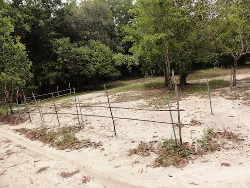 |
| Site 2. minimal fence. |
 |
| Site 2. Pillar base. |
 |
| Site 2. location. |
Unknown site
I came across this walking back from site 3 to site 2. Scattered bricks, but with some structure, and what looks to be a base for a pillar or a column or a corner of a building? I will leave this for the experts to decide.
Site 3
This is a square foundation structure, with what looks to be an entrance way on its eastern side. The square section has a large, ~1m square hole in the centre, an area of worship or a shrine of some sort. Brick construction. Well defined foundation. This is the site with a plaque.
Bricks: 25x14x6cm.
 |
| unknown. a pile of bricks, and a foundation. |
 |
| unknown. The foundation ? |
Site 3
This is a square foundation structure, with what looks to be an entrance way on its eastern side. The square section has a large, ~1m square hole in the centre, an area of worship or a shrine of some sort. Brick construction. Well defined foundation. This is the site with a plaque.
Bricks: 25x14x6cm.
 |
| Site 3. Central dais. |
 |
| Site 3. Looking back towards plaque. |
 |
| Site 3. plaque. |
 |
| Site 3. Location. |
Site 4
The largest, and visually the most impressive. A rectangular structure running east-west. The entrance was most likely a portico on the eastern side, flanked by two stone columns. Next the main area: rectangular, ~6m x 9m, with a large ~2m square central hole, most probably for a religious statue. As this is the second largest construct (after site 1) perhaps this was one of the last temples to be created?
Bricks: 22x13x5cm.
Bricks: 22x13x5cm.
 |
| Site 4. viewed from the north west. Dais visible. |
 |
| Site 4: sherds on site. |
 |
| Site 4. Viewed from south east. Portico foundation visible. |
 |
| Site 4. Location. |
Site covered with white sand by the Fine Arts Dept archaeolgists, presumably for protection. A small, circular mound of sand ~2m diameter. This was a water well.
 |
| Site 5. White sand, in a circle. |
Site 6
I could not find this site. Vegetation, trees, and no visible sign.
Site 7
Site covered with white sand, presumably for protection. ~square building, ~8m on a side, bricks, and some coral (as was site 1) used in construction. Indication of a central dais.
 |
| Site 7. A mound of white sand. |
Site 8
Apparently, similar in design to site 2, but smaller, possibly an earlier version(?). Foundation of stone, with brick walls, signs of a central raised area.
|
| Site 8. Another white mound of sand. |
 |
| Site 8. Location, location. |
Comments